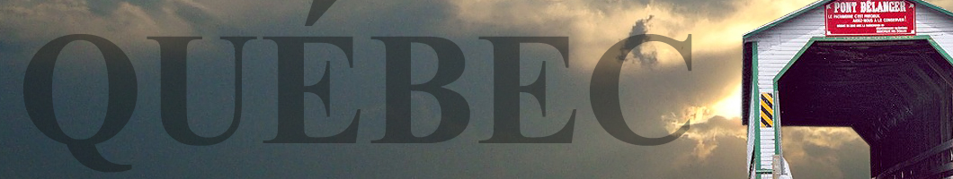
ponts couverts dans le monde
bedeckte Brücken der Welt
世界各地的棚桥
61-66 comté LOTBINIÈRE
county/grafschaft
4 ponts
couverts/covered bridges/bedeckte holzbrücken
![]()
Ce symbole indique que la traduction de cette liste fut effectuer à partir
de l'anglais au Français et à l'Allemand par ATAWALK
This symbol indicates this listing has been translated from English to French
and German by ATAWALK
Dieses Symbol deutet darauf hin, dass diese Auflistung von ATAWALK vom Englischen
ins Französische und Deutsche übersetzt wurde.
LOTBINIÈRE– The former World Guide number for this county
was 61-40-00 • L'ancien
numéro du guide mondial était 61-40-00
Die ehemalige Weltführerzahl für diese Grafschaft war 61-40-00
MÉGANTIC– The former World Guide number for this county was
61-44-00 • L'ancien numéro du guide mondial était 61-44-00
Die ehemalige Weltführerzahl für diese Grafschaft war 61-44-00
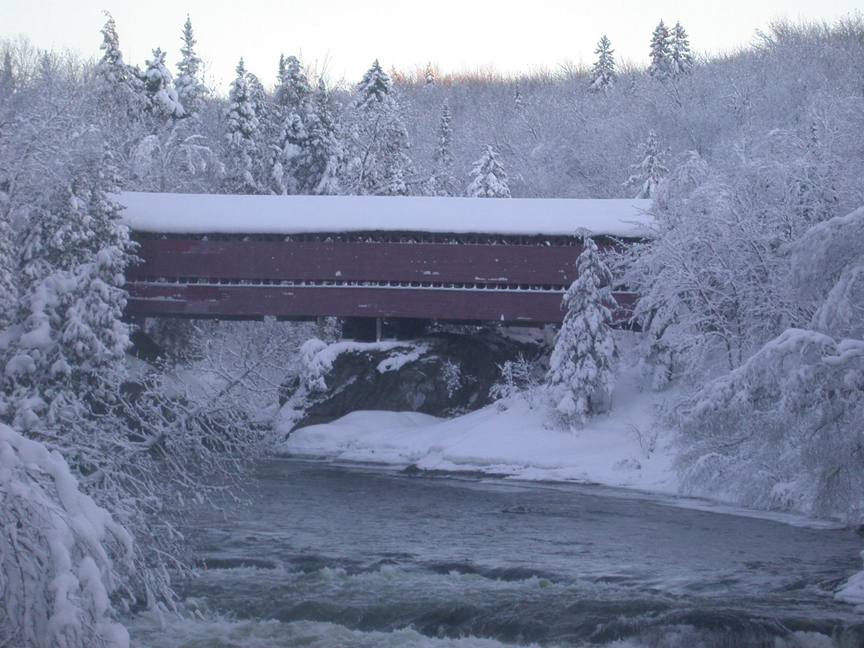
STE-AGATHE DE LOTBINIÈRE
|
61-66-01 |
Environ 8,3 Km au sud ouest de Ste-Agathe de Lotbinière sur le chemin Gosford. About 8.3 Km south-west of St. Agathe of Lotbiniere on Gosford road 8,3 Kilometer Südwestlich von St. Agathe von Lotbiniere auf Gosford Straße |
Rivière Palmer Palmer River Fluß Palmer |
Pont couvert Rouge ou de Reed-Mill Reed-Mill or Red covered bridge Rotte Holzbrücke oder Reed-Mühle |
Environ 33 Km au sud-est de la sortie 278 de la A20 à Laurier-Station sur la Qc271 passer Dosquet jusqu'à Ste-Agathe, à droite 4,8 Km sur la rue Gosford jusqu'au chemin Gosford, a gauche 2,6 Km jusqu'au pont. About 33 Km south-east of exit 278 of A20 at Laurier Station on Qc271 past Dosquet to Ste. Agathe, right on Gosford Street 4.8 Km to Gosford Road, left, 2.6 Km to the bridge. Etwa 33 Kilometer südöstlich von Ausfahrt 278 auf A20 am Laurier Station aus Qc271 Vergangenheit Dosquet am Ste. Agathe, Rechts auf Gosford Straße 4,8 km zu Gosford Weg, links, 2,6 km bis zur Brücke. |
2 |
130' 39.6m |
Construit en 1928 par le ministère de la colonisation Built in 1928 by the Quebec ministry of colonization Errichtet 1928 durch das Quebec Ministerium der Besiedlung |
Treillis Town élaboré Town Quebec Variant Quebec Version des Town Träger |
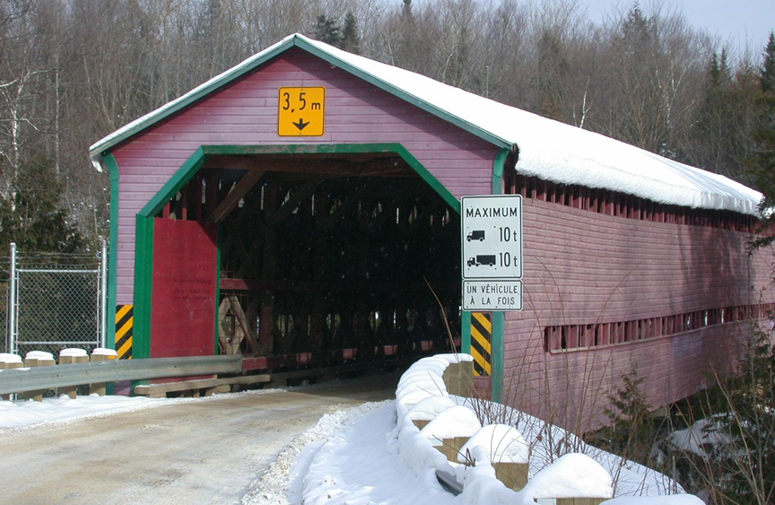
Pont couvert de Sainte-Agathe-de-Lotbinière, fotos Michel!
ST-SYLVESTRE
|
61-66-03 |
À l'ouest de St-Sylvestre dans le rang St-André West of St-Sylvester on St-Andrew Rural Road Westlich von St. Sylvestre auf Weg St-Andre |
Rivière Filkars Filkars River Fluß Filkars |
Pont couvert du rang St-André St-Andrew Road covered bridge Holzbrücke Weg St-Andre |
Environ 43 Km au sud-est de la sortie 278 de la A20 à Laurier-Station sur la Qc271 passer Dosquet et Ste-Agathe, à gauche au rang St-Michel environ 2 Km jusqu'au rang St-André et au pont. About 43 Km south-east of exit 278 of A20 at Laurier Station on Qc271 past Dosquet and Ste. Agathe, left on St-Michel rural road about 2 Km to the bridge at St-Andrew side road Etwa 43 Kilometer südöstlich von Ausfahrt 278 auf A20 am Laurier Station aus Qc271 Vergangenheit Dosquet und Ste. Agathe, links auf St-Michel ländlichen Straße ca. 2 km bis zur Brücke in St. Andrew ländlichen Straße |
1 |
79' 24m |
Construit en 1927 par le ministère de la colonisation Built in 1927 by the Quebec ministry of colonization Errichtet 1927 durch das Quebec Ministerium der Besiedlung |
Treillis Town élaboré Town Quebec Variant Quebec Version des Town Träger |
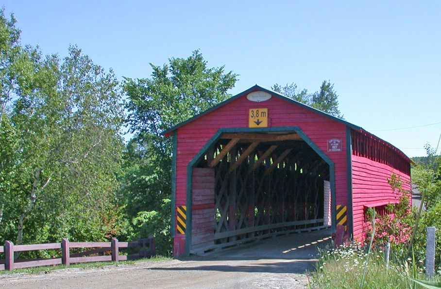
St-Sylvestre, pont du rang St-André, foto MICHEL!
VAL-ALAIN
|
61-66-04 |
À l'est du village de Val-Alain sur le 1er rang East of Val-Alain on Rural Road 1 Östlich von des Dorf Val Alain auf ländliche Straße 1 |
Rivière du Chêne Oak River Fluß der Eiche |
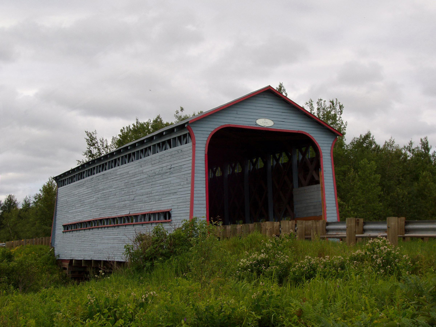
Pont couvert Caron Caron covered bridge Holzbrücke Caron |
Environ 8 Km à l'est de la sortie 261 de la A20 passer Val-Alain, à gauche au rang 1 environ 3.5 Km jusqu'au pont. About 8 Km east of exit 261 of A20 past the village of Val-Alain, left on rural road 1 about 3.5 Km to the bridge. Ca. 8 km östlich von Ausfahrt 261 auf A20 Vergangenheit des Dorf Val Alain, links auf den ländlichen Straße 1, 3,5 km zum die Brücke |
1 |
80' 24.5m |
Dernier survivant du trio construit sur moin d'un mile par le ministère de la colonization en 1933 Last of the three covered bridges built within a mile in 1933 by the Quebec ministry of colonization, Zuletzt einer von drei Brücken, errichtet 1933 durch das Quebec Ministerium der Besiedlung |
Treillis Town élaboré Town Quebec Variant Quebec Version des Town Träger |
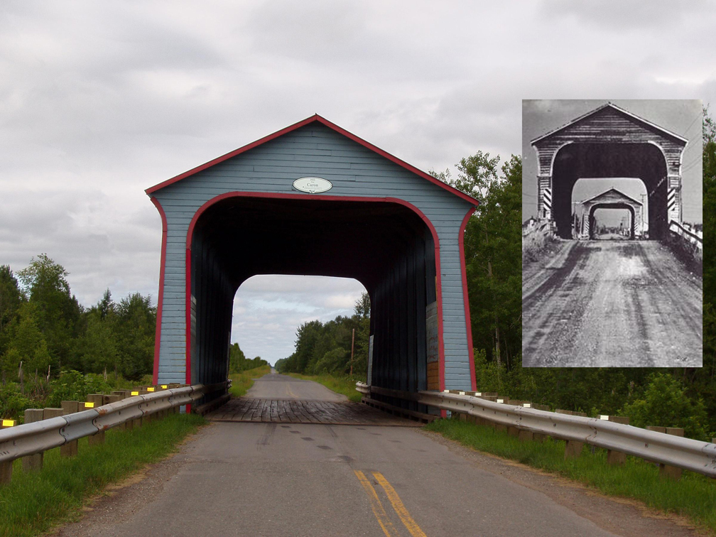
Val-Alain, le ponr couvert Caron, foto MICHEL!
ST-NORBERT D'ARTHABASKA
|
61-66-08 |
Au nord-est de North-east of St-Norbert of Arthabaska on Lambert road Nordöstlich von des Dorf St-Norbert auf Lambert Straße |
Rivière Bulstrode Bulstrode River Fluß Bulstrode |
Pont couvert Lambert Lambert covered bridge Holzbrücke Lambert |
Environ 15 Km au sud-est de la Qc116 à Princeville sur la Qc263 passer le village de St-Norbert, à gauche sur la route de la Montagne, encore a gauche sur la route de Ste-Sophie jusqu'au chemin Lambert et au pont. About 15 Km south-east of Qc116 at Princeville on Qc263 past the village of St-Norbert (Norbertville) and left on Mountain road, left again on St, Sophie road to the bridge at Lambert road. Ca.15 Kilometer südöstlich von Qc116 am Princeville auf Qc263 Vergangenheit des DorfSt. Norbert (Norbertville) und links am Berg Straße, wieder links auf St, Sophie Straße auf der Brücke an der Straße Lambert. |
1 |
88' 27m |
Construit par le ministère de la colonization en 1948 Built in 1948 by the Quebec ministry of colonization, Errichtet 1948 durch das Quebec Ministerium der Besiedlung |
Treillis Town élaboré Town Quebec Variant Quebec Version des Town Träger |
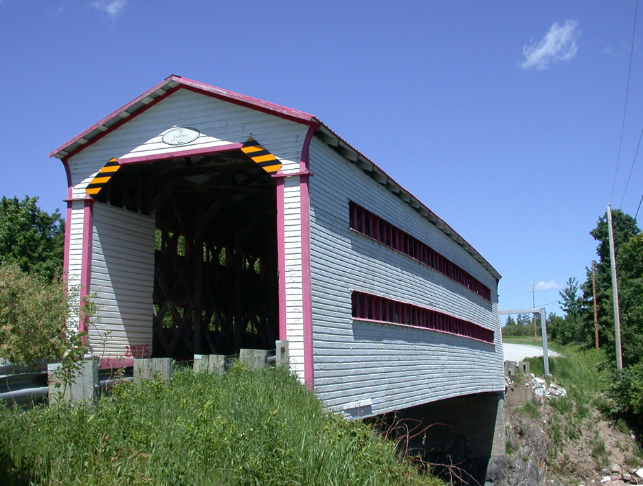
Sainte-Sophie
d'Halifax, foto MICHEL!