ponts couverts dans le monde
bedeckte Brücken der Welt
世界各地的棚桥
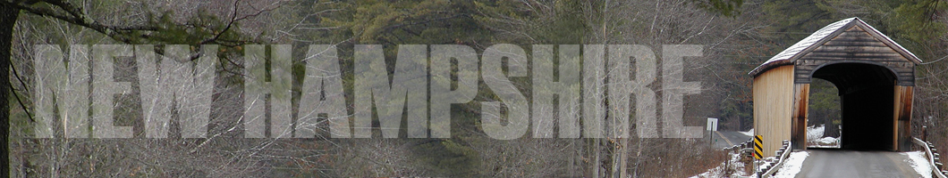
29-07 Merrimack county/comté/grafschaft
9 covered bridges/ponts couverts/bedeckte
holzbrücken
![]()
This symbol indicates this listing has been translated from English to French
and German by ATAWALK
Ce symbole indique que la traduction de cette liste fut effectuer à partir
de l'anglais au Français et à l'Allemand par ATAWALK
Dieses Symbol deutet darauf hin, dass diese Auflistung von ATAWALK vom Englischen
ins Französische und Deutsche übersetzt wurde.
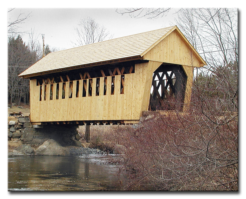
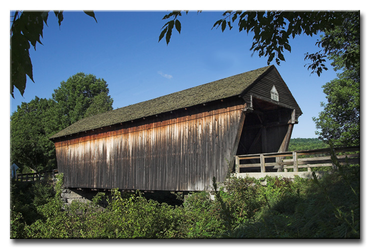
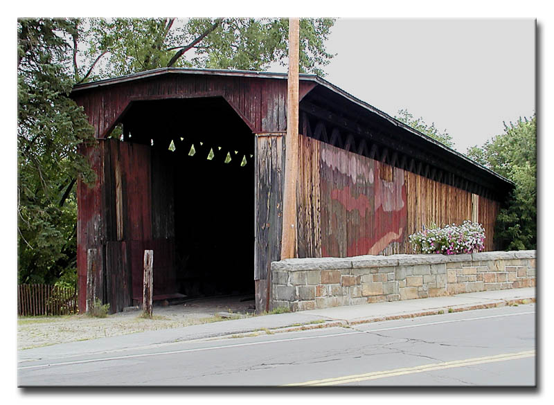
ANDOVER
| 29-07-01 |
South-west of Andover off NH11 Au sud-ouest de Andover près de la NH11 Südwesten von Andover neben NH11 |
Blackwater River Rivière des eaux noires (Blackwater) Schwarzer Wasserfluß (Blackwater) |
Cilleyville or Bog Bridge Pont couvert de Cilleyville ou du marécage Cilleyville oder Sumpf-Holzbrücke |
On NH11 at the jct of US4A at Andover Sur la NH11 tout près de l'intersection de la US4A à Andover Auf NH11 der Durchschnitt von US4A bei Andover |
1 | 53' 16.1m |
Built in 1887 by Print Atwood, completely rebuit in 2002 Construit en 1887 par Print Atwood, complètement reconstruit en 2002 Errichtet 1887 durch Print Atwood, vollständig umgebaut 2002 |
Town lattice Treillis Town Town Träger |
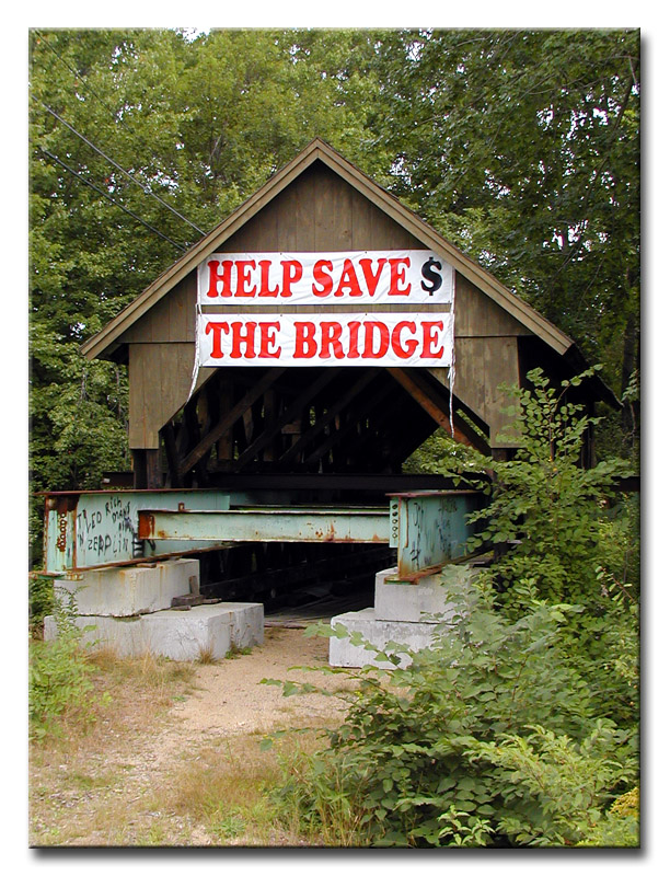
The photography of eJohn Waldron, the Cilleyville or Bog covered bridge
at Andover, a remarkable case or the "before-and-after" scenario!.
http://www.pbase.com/ejohnw
|
29-07-02 |
West of Andover-Village on the south side of US4 À l'ouest d'Andover-Village du côté sud de la US4 Westlich von Andover-Dorf auf der Südseite von US4 |
Blackwater River Rivière des eaux noires (Blackwater) Schwarzer Wasserfluß (Blackwater) |
Keniston Bridge Pont couvert de Keniston Keniston Holzbrücke |
About 1.5 miles west of US 4 on US 4/NH 11 then left on Lorden Road 0.2 mile to the bridge Environ 1.5 miles à l'ouest de la US4 sur la US4/NH11 et à gauche sur le chemin Lorden 0.2 mile vers le pont Ungefähr 1.5 Meilen westlich von US 4 auf US 4/NH 11, dann
linke auf Lorden Straße 0.2 Meile zur die Brücke |
1 |
63' 19.2m |
Built by Albert R. Hamilton in 1882 Construit en 1882 par Albert R. Hamilton Gebaut in 1882 durch Albert R. Hamilton |
Town lattice Treillis Town Town Träger |
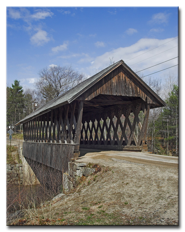
The photography of eJohn Waldron, the quaint Keniston bridge
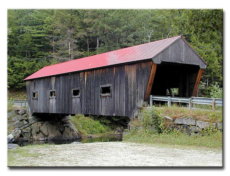
BRADFORD
|
29-07-03 |
At the south-east edge of Bradford NH103 À la limite sud-est de Bradford près de la NH103 Am Südostrand von Bradford neben NH103 |
West Branch of the Warner River Branche ouest de la rivière Warner Westen Warner-Nebenfluß |
Bement covered bridge Pont couvert Bement Bement Holzbrücke |
0.3 mile west of NH114 at Bradford on NH103 then left 0.1 mile on Center Road 0.3 mile à l'ouest de la NH114 à Bradford sur la NH103 et à gauche 0.1 mile sur le chemin du Centre 0.3 Meile westlich von NH114 in Bradford auf NH103 dann linke 0.1 Meile auf Mittelstraße (Centre Road) |
1 |
63' 19.2m |
Reputed to have been built in 1854 by Colonel Stephen H. Long Construit, selon la légende, par le Colonel Stephen H. Long en 1854 Gebaut in 1854 nach der Legende von Colonel Stephen H. Long |
Long truss Ferme Long Long Träger |
The Bement covered bridge at Bradford, photo eJohn Waldron
WARNER
|
29-07-04 |
West of Warner on New Market Road À l'ouest de Warner sur le chemin New- Market Westen von Warner auf Neu Markt Straße |
Warner river Rivière Warner Warner Fluß |
Waterloo Bridge Pont couvert Waterloo Waterloo Holzbrücke |
1 mile west of I-89 at exit 9 on NH 103 then left 0.3 mile on New Market Road to the bridge 1 mile à l'ouest de la I-89 à la sortie 9 sur la NH 103 et à gauche sur le chemin New-Market 0.3 mile vers le pont 1 Meile westlich von I-89, Ausfahrt 9 auf NH 103, dann linke 0.3
Meile auf Neumarkt-Straße zur die Brücke |
1 |
76' 23.1m |
Built around 1840, rebuilt by Dutton Woods in 1857, rebuilt again in 1970 and in 1987 by the state Construit vers 1840, reconstruit en 1857 par Dutton Woods et encore en 1970, et 1987 par l'état Errichtetes herum 1840, umgebaut durch Dutton Woods 1857, umgebaute wieder 1970 und 1987 durch den Zustand |
Town lattice Treillis Town Town Träger |
The Waterloo bridge near Warner, photo from the magic eye...
http://www.pbase.com/ejohnw
|
29-07-05 |
South edge of Warner on Joppa Road À la limite sud de Warner sur le chemin Joppa Südrand
von Warner auf Joppa Straße |
Warner river Rivière Warner Warner Fluß |
Dalton or Joppa Road Bridge Pont couvert Dalton ou du chemin Joppa Dalton oder Joppa Straße Holzbrücke |
1 mile à l'ouest de la I-89 à la sortie 8 sur la NH103 et à gauche 0.2 mile sur le chemin Joppa 1 Meile westlich von I-89 an herausnehmen 8 auf NH 103 dann 0.2
Meile verließ auf Joppa Straße zur Brücke |
1 |
76' 23.1m |
Built in 1853 by Joshua Sanborn. George Sawyer and Walter S. Davis built the abutments. Completely rebuilt in 1963-64 Construit en 1853 par Joshua Sanborn. George Sawyer et Walter S. Davis construisirent les fondations. Entièrement reconstruit en 1963-64 Errichtet 1853 durch Joshua Sanborn. George Sawyer und Walter S. Davis errichteten das Angrenzen. Vollständig umgebaut 1963-64 |
Long truss & Queen post reinforcement Ferme Long avec renforcement Queen Long Träger mit Queenpfostens Verstärkung |
The Dalton or Joppa Road bridge near Warner, photo by eJohn Waldron
CONTOOCOOK
|
29-07-07 |
In the town of Contoocook off NH 103 Dans la ville de Contoocook sur la NH103 In der Stadt von Contoocook neben NH103 |
Contoocook River Rivière Contoocook Contoocook Fluß |
Old Contoocook Rail Road Bridge Vieux pont couvert de chemin de fer de Contoocook Alte Contoocook Eisenbahn-Holzbrücke |
About 10 miles west on Concord on I-89 at exit 6, just north of NH127 on the west side of NH103 in the town of Contoocook Environ 10 miles à l'ouest de Concord sur la I-89 à la sortie 6, juste au nord de la NH127, du côté ouest de la NH103 en villa à Contoocook Ungefähr 10 Meilen West auf der Stadt von Concord auf I-89 an Ausfahrt 6, Norden von NH127 auf die Westseite von NH103 in der Stadt von Contoocook |
2 |
157' 47.8m |
Built in 1889, restored in 1995 Construit en 1889, restaurer en 1995 Errichtet 1889, wieder hergestellt 1995 |
Double web Town lattice Double treillis Town Doppeltes Netz Town Träger |
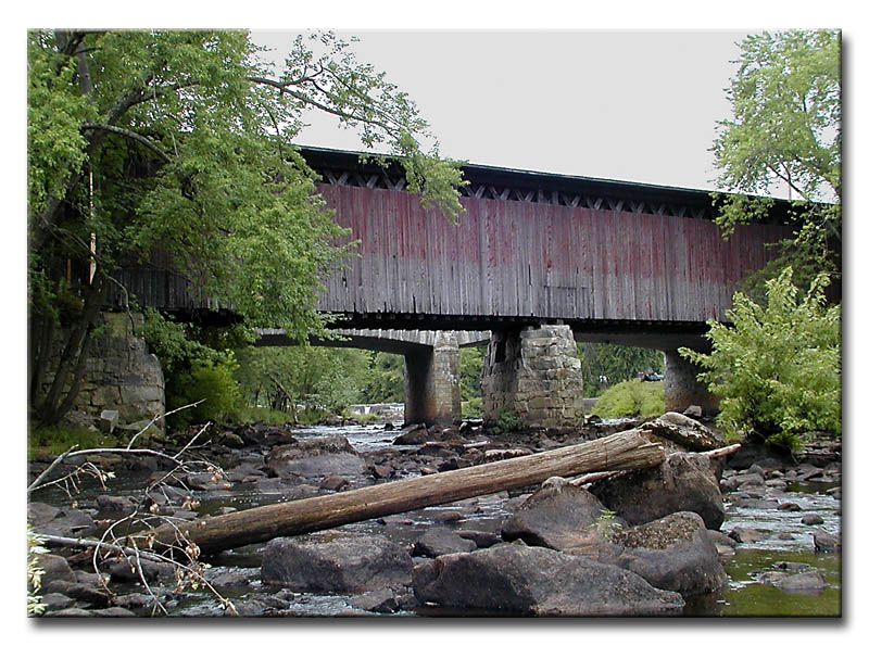
The immense Contoocook Rairoal covered bridge, photos eJohn Waldron
http://www.pbase.com/ejohnw
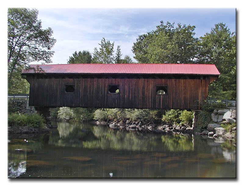
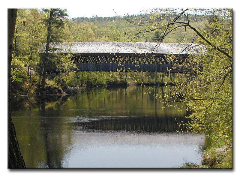
WEST-HOPKINTON
|
29-07-08 |
At the village of West Hopkinton on Clement Hill Road Au village d'Hopkinton-Ouest sur le chemin de la côte Clement Am Dorf von WestHopkinton auf Clement Hügel-Straße |
Contoocook River Rivière Contoocook Contoocook Fluß |
Rowell's Bridge Pont couvert Rowell Roweller Holzbrücke |
About 10 miles west of Concord on I-89 to exit 6 then west 2.5 miles on NH127 then right on Clement Hill Road to the bridge Environ 10 miles à l'ouest de Concord sur la I-89 jusqu'à la sortie 6, puis vers l'ouest 2.5 miles sur la NH127 et à droite sur le chemin Clement Hill Ungefähr 10 Meilen westlich von Concord auf I-89
zu den Ausfahrt 6, dann Weslich 2.5 Meilen auf NH127, rechts auf
Clement Hügel-Straße zur die Brücke |
1 |
167' 50.9m |
Built in 1853 by Horace, Enoch and Warren Childs, rebuilt in 1965 and 1982 Construit en 1853 par Horace, Enoch et Warren Childs, reconstruiten 1965 et 1982 Errichtetes in 1853 durch Horace, Enoch und Warren Childs, umgebaut in 1965 und 1982 |
Long truss with arches Ferme Long avec arches Long Träger mit bögen |
The Rowell bridge at West-Hopkinton, photo eJohn Waldron
FRANKLIN-FALLS
|
29-07-09 |
South of Franklin Falls off US3 Au sud de Franklin Falls près de la US3 Süden von Franklin fällt neben US3 |
Winnipesaukee River Rivière Winnipesaukee Winnipesaukee Fluß |
Sulphite Bridge Pont Sulphite Holzbrücke |
1.5 mile east of Franklin Falls and south of US3 over the Winnipesaukee River on the Boston and Maine Railroad line. 1.5 miles à l'est de Franklin Falls, au sud de la US3 sur la ligne ferroviaire du Boston & Maine à la rivière Winniepsaukee 1.5 Meile östlich der Franklin Fälle und Süden von US3 über dem Winnipesaukee Fluß auf der Boston und Maine Eisenbahn zeichnen. |
3 |
231' 70.4m |
Built in 1896, abandonned since 1973, damaged by fire in 1980 Construit en 1896, abandonné depuis 1973, endomagé par le feu en 1980 Errichtet 1896, verlassen seit 1973, beschädigt durch Feuer 1980 |
Above deck Pratt truss Ferme Pratt avec tablier supérieur Über Plattform Pratt Träger |
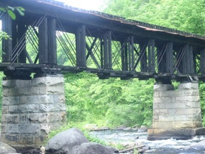
The charred but still standing Sulphite bridge, for more photos:
http://www.fh-nb.de/biw/caston/haer/haer.html
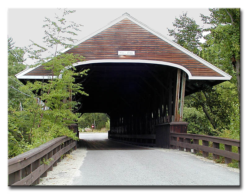
HENNIKER
|
29-07-12 |
At Henniker on the New-England College Campus À Henniker au campus du collège de la Nouvelle-Angleterre Bei Henniker auf dem Neu-England Hochschulcampus |
Contoocook River Rivière Contoocook Contoocook Fluß |
New-England College Bridge Pont couvert du collège de la Nouvelle Angleterre Neu-England Hochschulbrücke |
About 15 miles west of Concord on US202 then about a mile south on NH114, then right 0.l mile and left 0.2 mile to the bridge Environ 15 miles à l'ouest de Concord sur la US202 et encore 1 miles au sud sur la NH114, à droite 0.1 mile et à gauche 0.2 Ungefähr 15 Meilen westlich von Concord auf US202, dann ungefähr 1 Meile Süd auf NH114, dann rechte Meile 0.l und linke 0.2 Meile zur die Brücke |
1 | 130'
39.6m |
Built by Milton Graton and his son Arnold in 1972 Construit par Milton Graton et son fils Arnold in 1972 Errichtet 1972 durch Milton Graton und sein Sohn Arnold |
Town lattice Treillis Town Town Träger |
The beautiful Henniker bridge at the New-England College Campus, photo eJohn
Waldron
http://www.nec.edu/